|
|
|
|
|

Amer Lake - Thelon Region
Highlights
- Uranium North can earn 100% interest in the permits;
- Numerous targets over 125,000 acres in geological setting similar to the Kiggavik deposit;
- Main and Faucon showings - A reference to a historic uranium resource has been identified on the property (noncompliant with NI 43-101 - "indicated resource"* of 3.1 million tonnes grading at an average of 0.07% U3O8, and "inferred resource"* of 1.2 million tonnes at 0.07% U3O8) in an area with boulders yielding up to 5.4% and 8.8% U3O8;
- Horned Lake - U3O8 in boulders up to 5%, bedrock source(s) may not be fully explained;
- Split Lake - Uranium bearing boulders and bedrock samples up to 1.5% U3O8;
- Uranerz Grid 1 - Radioactive boulders and bedrock samples up to 1.9% U3O8;
- Showing B - Approximately 50 boulders identified assays as high as 0.7% U3O8.
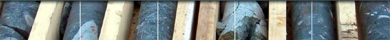
Click to Enlarge

The Amer Lake Property, in the Thelon region, comprises four prospecting permits near Amer Lake that have been optioned by the Company (see Diamonds North News Release NR06-16 for details).
The primary exploration target on the property is a basement-hosted uranium deposit comparable to the Kiggavik/Sissons Schultz deposits (resource of ~150 million lbs U3O8, reported by Areva) located in a similar geologic setting approximately 90 kilometres southeast of the Amer Lake property.
This permit block encompasses numerous historic uranium occurrences in outcrop, drill core and boulders. One of the highlights is a boulder discovered by Uranerz Exploration and Mining which assayed 8.8% U3O8 in the vicinity of a uranium resource defined by Aquitaine Company of Canada. The Amer Lake rocks are interpreted to be geologic equivalents of the Wollaston Fold Belt that underlies portions of the Athabasca Basin.
Initial review by MPH of historic exploration on the property identified five priority targets for follow-up on the permit block
-
Main and Faucon Showings: Located in the central portion of the permit block, assessment reports indicate a historical resource and boulders with assays as high as 8.8% U3O8 in the area of the Faucon showing and 5.4% U3O8 in the area of the Main showing. Other highlights from the area (showing B) include U3O8 values from boulders up to 0.63% and 1.7% in bedrock.
The Faucon Showing was originally held by Aquitaine with Cominco Ltd. as an option partner. Both companies reportedly drilled several holes in the area intersecting several 1 to 2.5 metre intercepts with U3O8 ranging from 0.1 to 0.18%. Reference to an "ore reserve summary" for the Main Zone uranium occurrence in a 1978 assessment report by Cominco Ltd was identified during data compilation. The summary was prepared by Aquitaine in 1969-70 based on approximately 30 drill holes totalling 6280 metres of drilling. The drilling was referenced by Cominco as yielding "a moderately regular array of intersections." Some details of the "ore reserve summary" have been located and a comprehensive review will be undertaken to better understand the data. Previous drilling has been reported to outline estimated "indicated resource"* of 3.1 million tonnes averaging 0.07% U3O8, with zones up to 0.15% U3O8. This equates to approximately 4.8 million pounds of U3O8. Additional "inferred resource"* of 1.2 million tonnes grading 0.07% U3O8 were also reported, equating to approximately 1.9 million additional pounds of U3O8. The zone was reported as being open in both directions along strike and to the south down dip. (This resource estimate is not compliant with NI 43-101 and should not be relied upon as insufficient qualifying exploration has been carried out to delineate a NI 43-101 compliant mineral resource and it is uncertain if further exploration will result in the target being delineated as a mineral resource).
The priority for this showing is to confirm the historic uranium resource on the property as reported by Cominco and to locate the bedrock sources of the boulders that returned 8.8% and 5.4% U3O8 to a bedrock source.
-
Horned Lake Boulder Field: Approximately 500 uranium bearing boulders extending for about 3 kilometres in a northwest-southeast direction was delineated by Uranerz in the late 1970's. Assays of 52 boulder samples from the area averaged 0.53% U3O8 with individual assays up to 5.1% U3O8. It is not clear that the bedrock source(s) of the boulders has been fully explained.
-
Split Lake Showing: A separate and parallel boulder field associated with uranium showings in bedrock was identified one kilometre north of the Horned Lake Boulder Field. Bedrock grab samples from the area have returned assays up to 1.5% U3O8. It does not appear that a bedrock source for these boulders was ever identified.
-
Garry Lake Boulder Field: Aquitaine and Uranerz discovered boulders grading to 0.5% U3O8 along the north shore of Garry Lake extending for about 1.5 kilometres. According to assessment reports, the source of these boulders has not been found.
-
Uranerz Grid 1: Numerous uranium bearing boulders and bedrock uranium occurrences have been located at this site with grab samples of outcrop returning up to 1.9% U3O8. No record of any drilling was identified in the assessment reports.
* In the historical reports the "indicated resources" and the "inferred resources" were reported as "indicated reserves and "inferred reserves" respectively.
|
|
|
|